My plan was to hike 10 days on the Oregon Coast Trail in preparation for hiking the Blue Mountains Trail in July with my husband, John, and our friend Gretzky (Weston). My sense was that I needed the extra time hiking to get my body in shape. In the past I have started thru hikes with no training whatsoever, and I have known countless other hikers to do so, but after being quite sedentary in my job and also not devoting much focused energy to training, I felt that I needed the extra time preparing. Not only physically either. I didn’t necessarily feel that I was in the right mental headspace for a difficult trail when I quit my job at the end of May. I felt that I needed a break before I took a break. Life had been moving at a breakneck pace in 2024, including a move of our tiny house, several trips to Washington to be present with my family in times of need, and spending more and more time getting integrated in new communities and endeavors. I needed to adjust to the pace that life takes when you’re hiking, the choices you need to make which are so different from the choices we make day to day at home, the push and pull of gaining miles and always pushing for a destination while also trying to meet the needs of your body. Life is simple when you’re hiking in a way that my life has not been simple, and I felt like I needed to take some time to adjust to that pace on a trail where I didn’t have so much pressure to make miles and get to checkpoints by a certain timeframe. The Oregon Coast Trail (OCT) seemed like the perfect place to do that.
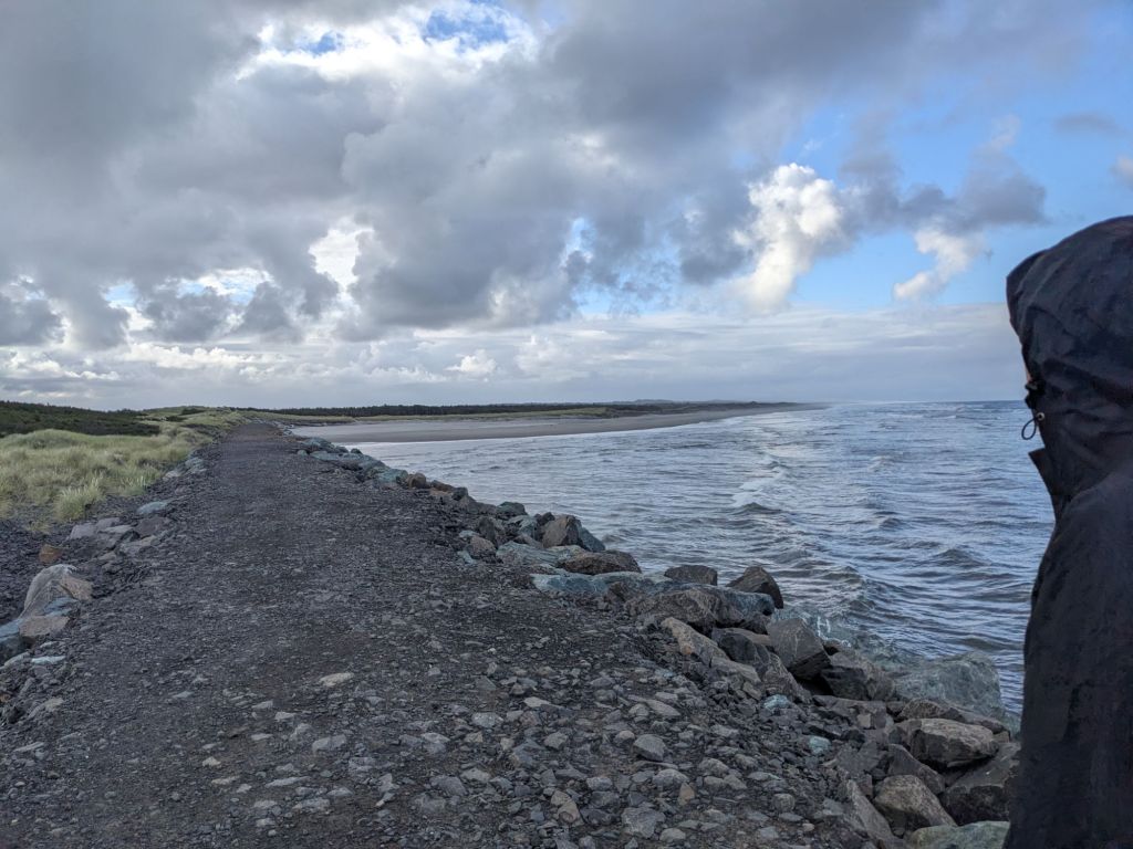
The OCT is not a wilderness trail. Nearly every day you may be passing through some sort of coastal town or resort. There are hotels and coffee shops and grocery stores a plenty. There are campgrounds with showers and chargers, tourist attractions, and potable water available in plenty. (In fact, it’s not advisable to gather water from rivers and surface streams along this trail, except maybe from springs found on the headlands. By the time water makes it to the ocean it is so highly polluted by runoff from farms, roadways, and other industrial pollutants, that even filtering is unsafe.) The OCT is also largely flat. It follows the Oregon coastline for roughly 400 miles (depending on the number of fishing boats you hail to help you cross various inlets and coves, and failing to do so, the number of long road alternates you will be required to take), from Fort Stevens State Park at the Columbia River, to the California border 8 miles south of Brookings. The majority of that hiking takes place on the beach. As you can imagine, elevation is not even a daily occurrence in many places, although the trail does depart the sandy beaches to traverse over headlands and around coves, sometimes taking to Highway 101, but for the most part sticking to footpaths, country lanes and local avenues. Undesirable road stretches can often (but not always as I would learn) be hitchhiked in search of more interesting terrain, and sometimes there are busses which can be utilized to the same end.
My goal starting out was to make it at minimum some 141 miles to Lincoln City. That would give me some time to get my trail legs on, maybe drop some excess pounds which won’t serve me in the Wallowas, and get my mindset ironed out. I had to remember how to do hard things, and to enjoy doing them. I had to remember how to suffer, and still look up and see the beauty around me, to be elated and also stay grounded, for good times are fleeting and highs must always find their lows. I believe life should always be traveled on flat ground in a sense, even keeled although the terrain may vary.

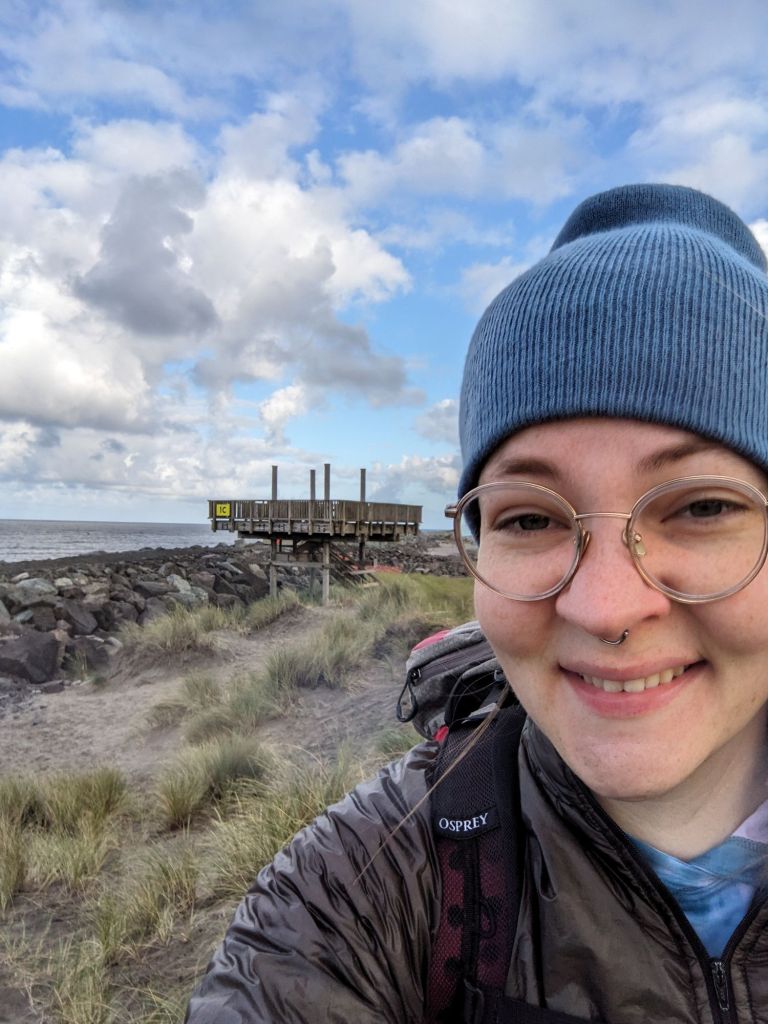
On June 16th John drove me to Fort Stevens State Park in Astoria, OR, and we camped together that first night. I woke up quite early on the 17th, not having slept well. There was also a lot of noise until pretty late at the campsite, which I hoped was not a bad omen as I would be staying in quite a few state parks. We packed up and headed to the trailhead without even eating breakfast, John still had to drive home so we wanted to get him on the road in good time. We said our goodbyes, it would only be 10 days but it felt strange to leave him behind. I hiked out and was quickly disappointed to realize I had left my EmergenC pouches in the car. I had been sick for the last several days and felt that I was on the upswing so chose not to delay the hike, but I was blowing my nose constantly and looking for any kind of boost to my immune system. Not two miles out I heard my name being called into the wind and turned to see John at the top of the dune, waving me down with the EmergenC pouches. He had driven to the next beach access point and raced to get down the beach before I passed. I was very glad to see him as I had been doing the math on where I could camp that night and realized it might end up being a much longer day than I wanted.
Camping on the OCT is something of a problem. There are many state parks with Hiker/Biker camp areas where you can camp for just $8/night without a reservation, but these are not always placed at ideal locations. Dispersed beach camping is allowed at times, but not within a few miles of a town and not in designated Snowy Plover protection zones. The Snowy Plover is a bird which nests in the dry sandy dunes, but the introduction of European Beach Grass to Oregon’s beaches severely limited their nesting grounds, making them endangered. Dispersed camping is also not allowed in State Parks and conservation zones, so the options become even more narrow. Particularly in this first section, given the proximity to Portland, my options were highly limited. I asked John to give me a ride down the trail a ways so I could make sure to get to a legal campsite tonight. I skipped about 7 miles, but I didn’t feel that I missed anything. My approach to this trail was going to become much more relaxed than other trails I had hiked.
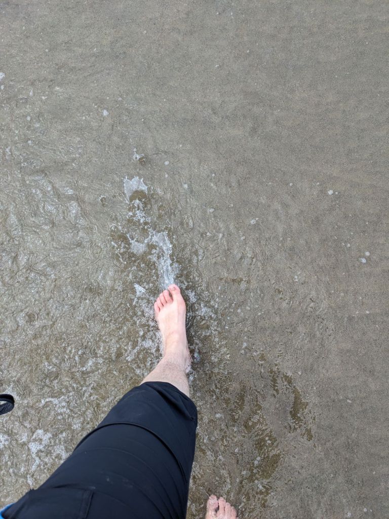
The first 11 miles were all on the beach or through town so it was flat. My hips and feet were quite sore by the time I got out of Seaside, just from the same repetitive motion on flat ground, and of course the pack weight, which is heavy because I’m carrying all the gear and not splitting it with John as usual. But the waves were beautiful and the hard packed sand was nice to walk on. I realized the beach is kind of just a graveyard for the sea, there are so many dead things on it. I walked first through Gearhart to get around the Necanicum river and enjoyed looking at the cute beach houses with curated gardens. There was a brief stint on the 101 which was less enjoyable and then I was in Seaside. I had been to Seaside before and it was much as I remembered it: full of tourists and shops that have been updated but still bare the sort of classic, old timey vacation town. Many coastal tourist traps that were once booming seem to be in a state of disrepair, but Seaside has been kept up and still feels like it probably did at its peak. There are hotels and condos a plenty, and on the way out of town I passed by many large, private, second home type residences built on the swell approaching Tillamook Head. I bought some saltwater taffy as is tradition when in Seaside, or probably any coastal resort town.
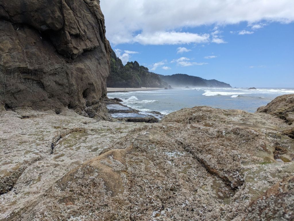
I soon left the hustle and bustle behind and began ascending Tillamook Head. Though the trail began with a flourish, it soon became confused and difficult to follow, until it downright disappeared, I backtracked and found where I had left of the trail, but couldn’t find where it was supposed to go. I followed the direction my map said the trail should go, a route that had clearly been taken by others and was easy enough to follow. It quickly turned into a scramble up the steepest portion of the shoulder of Tillamook Head without the aid of switchbacks, and there was lots of slippery mud, but plenty of handholds as well. I felt confident if I continued on I should encounter the trail again and sure enough I did. I continued on to the summit, and stopped there for dinner so I could avoid cooking at camp. Since it’s an established site in a pretty popular area, I know it’s one of the riskiest places for wildlife trying to get at your food (squirrels and mice are more of a problem than bears, but they are certainly a consideration too. I didn’t feel too great hiking the last two miles to camp, I ate too much food and started walking too quickly, but I was pretty tired by that point and just wanted to be done for the day.
I did 16 miles total and camped at a backpacker campsite on Tillamook Head, with multiple shelters and fire pit, and a viewpoint for the Tillamook Lighthouse. The guidebook says it’s known as Terrible Tilly because of how unreachable it is and difficult to maintain, at least 1 person died in the construction.

It was lonely when I first arrived. I forgot how hard it is getting to camp alone when you’re tired and not used to being outside all the time. Every unfamiliar noise startles you, and the void of space around you seems to press in, uncontained by walls. I was starting to remember how much more fun and rewarding it is hiking with people more than I like hiking alone. I was still glad to be there though. Towards 9 pm a couple other hikers showed up and set up camp. I didn’t talk to them but I could hear their movements and chatter and it was comforting to know I wasn’t alone.
The next several days proceeded in similar fashion. I was making good progress, but it became apparent that this was not going to be a typical trail. For one thing, it was so nice to walk on the beach. To watch and listen to the waves, to see the different marine life and flora, to not have to think about what elevation and climbing I would be doing for the day. The weather alternated from sunny to foggy, but it didn’t really truly rain, but it also didn’t get too hot. There were mosquitos in some campgrounds, but they were never too overwhelming. I also wasn’t beholden to a schedule. My plan was to go as far as I felt like going each day, as long as I was challenging my body and getting in shape for the BMT, so I was able to take long breaks at coffee shops, or at beach access points in town. One day I spent 30 minutes watching a group of 4 boys between 9 and 14 playing baseball in the sand, they seemed to be maybe cousins. They were actually pretty good and I was very engaged in watching them progress through a couple innings, squabbling over outs and foul balls and racing each other to the bases. At the same beach I observed 4 different Hole to China excavations, 6 popup beach tents, and 9 kites.
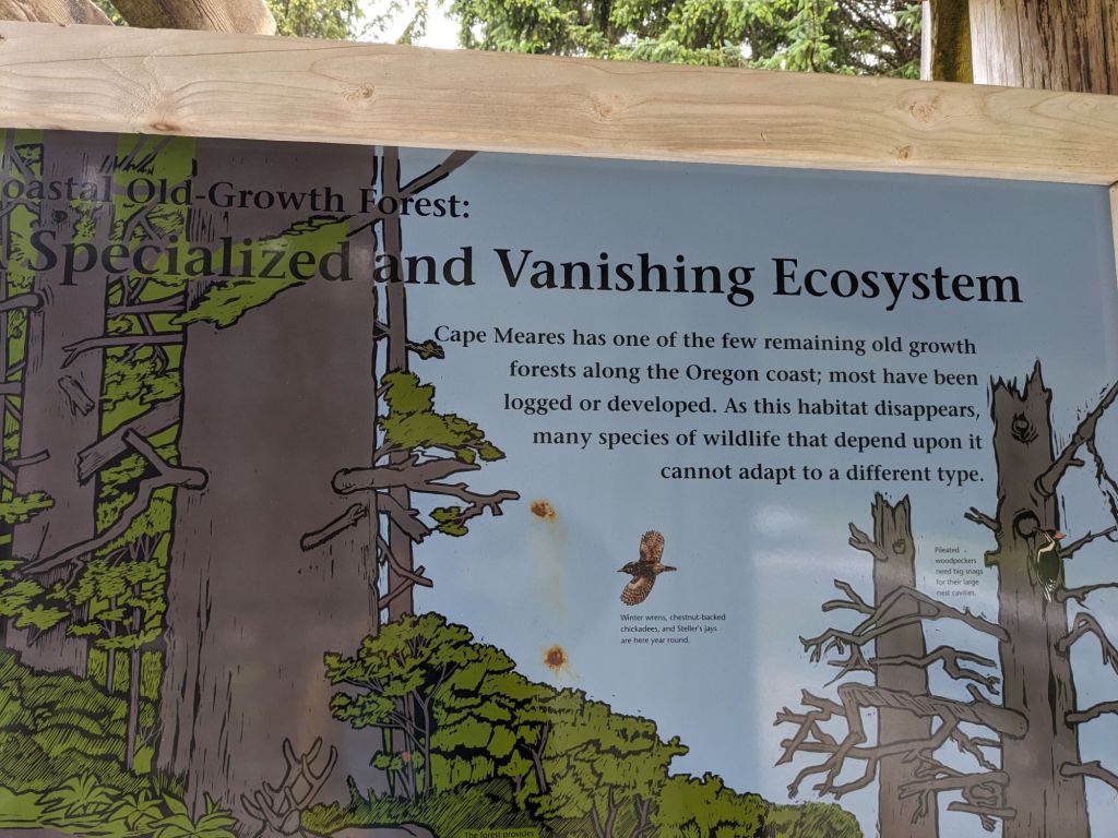
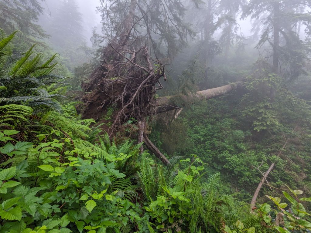
There were other challenges making the hiking difficult though. The camping logistics took a toll those first few days. After the first night, I realized it wasn’t advisable to camp without water given I was still sick. I woke up that first morning on trail with no water and had to hike 3 miles before I could drink and cook breakfast, and my congestion was making me feel like I was underwater. It was all downhill as I had camped at the top of Tillamook Head, but I just did my best to focus on walking through the old growth Sitka Spruce forest, to keep my head up and looking around at the nature around me even though I didn’t feel good. Some of the trees were truly monstrous, and an information kiosk informed me the biggest ones were over 150 years old. I was relieved at 2 miles to run across a stream flowing down from Tillamook Head so I did trust it as clean water so I got a liter to drink until I made it to the parking lot with a spigot for breakfast. Just after I got my water there it started to rain so I hid under a picnic shelter. I was debating at that point how many miles I should try to do and if I should try to get a room in town for the night since I was feeling so awful. After eating and drinking my mood lifted and I figured I would keep on going and just see where I ended up. By the time I got to Cannon Beach I was feeling much better. Every day after that my illness improved bit by bit, and I never did get to a point where it truly hindered my mileage.
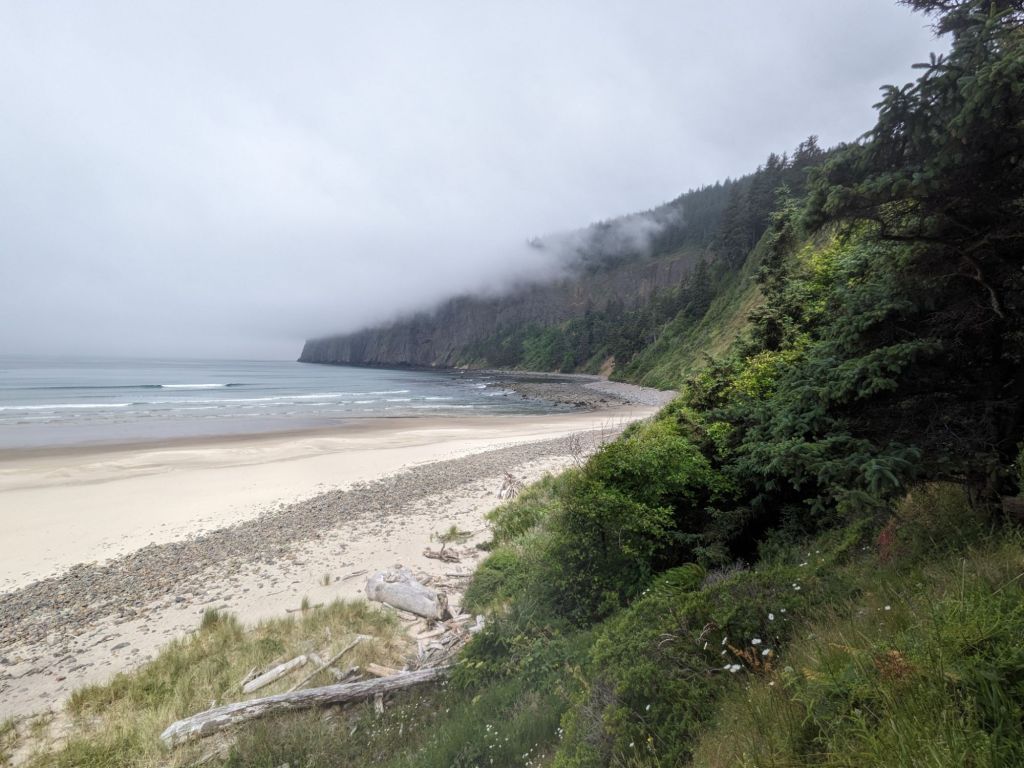
The tides posed another interesting problem that became more frustrating as the trail progressed. In some places it was merely a slight change to my schedule. On the section from Cannon Beach to Arch Cape, there are two places, Silver Point and Hug Point, which can only be crossed at low- mid tide, and it was high tide when I got into Cannon Beach. I bought some fresh fruit and a coffee at a cafe/grocery store and charged up my power bank to be productive while I killed time, and soon enough I was on my way again.
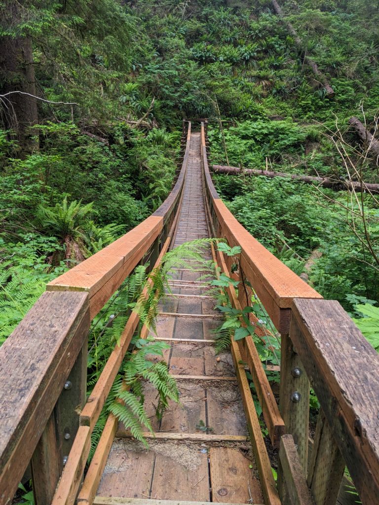
Other times though not paying enough attention to the tide got me into trouble, Sand Lake being the most crucial. I had taken my time getting out of camp that morning, walking out around 8:30. I had camped just before the ascent to Cape Lookout and I made quick work of the summit. I was resistant to hiking that morning, but once I started I powered over the hill, even though it wasn’t that big I was proud of myself for seeing some noticeable fitness improvements after just a few days of hiking. I took the North trail despite it being closed, a couple locals had advised me the day before that despite the signs, the washout was fairly insignificant, and repairs had already been completed to the bridge which had been damaged, and that the trail was too beautiful to pass up. There was indeed one small washout that you could very easily traverse around, and I could see where they had repaired the suspension bridge, it was fine now. Unfortunately I missed the spectacular views I was promised as the cape was entirely socked in with fog as is generally true in the mornings. As a result, I also got drenched towards the top of the cape, the fog condensing on the bushes turning the dense undergrowth into a “carwash”. The start of the descent was pretty chilly, but I got warmed up once I got down from the fog and back to the beach. It was a nice morning and sunny once I got to the beach. My thoughts were comfortably meandering, and not crowding in on me as they sometimes do when all you have to do all day is hike. I hiked 8 miles and hit Sand Lake where I planned to stop for lunch and assess the tide.
I had been aware that the river at Sand Lake could only be crossed at low tide, but I had considered that to be a “later me” problem. I had thought though that it was like some of the other “low tide” warnings I had seen so far and that really meant “mid to low” tide was safe enough. When “later me” got there and encountered a swelling river at high tide (1 pm) and started looking at the tide charts and comments in my navigation app, I realized crossing that day was going to be impossible. One commenter said the water was waist high at +3 feet, and the tide wasn’t going to hit +3 feet until 6 pm. I was under pressure to get to Pacific City, as I ate the last of my food for lunch there on the North side of Sand Lake. My only option was to take a 5 mile alternate (road walking) around Sand Lake, and then get back on the beach and keep walking. Doing the math, I realized that if I hiked every mile of the alternate, and the beach, stopped in Pacific City for a resupply then hiked out of town to a legal campsite, I would have hiked 28 miles for the day. My best hope was to try to get a hitch, which I ultimately was able to do.
I walked the entire alternate without anyone picking me up, although to be fair I did stop trying at a certain point. I wasn’t on the 101 anymore and everyone in the area seemed to be OHV tourists there with their dune buggies and dirt bikes. I had hiked a 2 mile stretch after Cape Lookout where OHV’s were allowed, and it was an oddly stressful experience to see little kids zipping around on the sand, sometimes coming straight for you, on foot. Although the alternate was a beautiful detour through a cow pasture with pleasant views of the estuary, I was beginning to be resentful of all the road walking and eventually just listened to an audiobook to get me through. Once I was back on the main route (still on the road) I was preparing to do 6 more miles to get to Pacific City before dinner time when I saw a bus stop for the free Pacific City shuttle. I was overjoyed and sat at the bus stop for 15 minutes to wait for the next route. It never came and I started walking again, disappointed. When I got into cell service I found online that the shuttle was not operating in 2024. Discouraged, I made a last ditch attempt to hitch at the parking area where the trail returned to the beach, I had only 4 more miles to go to Pacific City. A man who was pulled over there graciously agreed to take me – he had seen me having lunch at Sand Lake and took pity I think, I probably looked like I was going to cry, I was very tired and hungry by that time. He asked me if I was going to be any trouble which I found funny – I don’t think someone who is actually going to be trouble would admit to it if you asked them when they were looking for a ride.
Hitchhiking became much more of a staple for this hike than I had anticipated it being. Sometimes it was just to get myself to a legal campsite at a reasonable time. Sometimes it was to avoid long sections on the road, particularly the 101. A good example where hitching went very well in my favor was around Tillamook Bay.
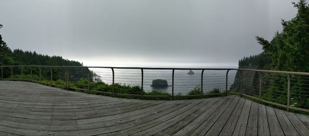
I had a vague notion of only hiking 10 miles that morning, feeling that I could do with an easy day. I was still dealing with more of the congestion and wanted to try to clear that up and not push myself, as well as get the blister developing on the ball of my foot to go down. I arrived first at the manmade spit on the North side of Tillamook bay mouth and, thinking I was just a mile or two from camp for the day, walked out far enough to experience the wind and get some good photos, and I was glad I did. Standing on the spit felt like standing on the end of the world, with the waves crashing and wind whipping, you can feel your existence shrink down to a pinprick, your ego meld into the flow of energy around you, and it is moments like this that I hike for.
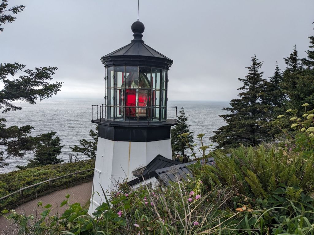
I arrived at the County park just before Garibaldi at 4 pm and realized I wasn’t ready to stop for the day, and I wasn’t too impressed by the accommodations at the county park. The problem was Tillamook Bay. There are two ways to get around the bay. Option 1: Call a ferry service to shuttle you across. That service closes at 4 though so it was too late, and expensive anyway. Option 2: Walk an extra 10 miles around the Bay through Tillamook. I was not impressed by that amount of road walking on the 101, and the camping options in Tillamook were also expensive and I wasn’t prepared to get a hotel. So I started walking on the narrow shoulder of the 101, thumb out and confident. I was very quickly picked up by a couple stoners out for a joy ride. They chattered about their misadventures and their “extracurricular” activities, but they took me to where the 101 meets Highway 131 in downtown Tillamook and graciously dropped me off with well wishes. I walked maybe a mile down Highway 131, headed back to the coast, and was able to hitch another ride with an Oceanside local headed home from work at the ReadyMix factory. My intention was to have him drop me off at Cape Meares then walk another mile out and camp on Bayocean Spit for my first night camping on the beach, but he was actually quite excited to have picked up an OCT hiker and was eager to show me the coolest places in the area. He advised me that the lighthouse at Cape Meares would be a very cool place to camp. I was already in the truck and didn’t want to have to backtrack out to the spit to camp, so I figured I would just let him take me where he thought was a good place. He dropped me off at the top of Cape Meares head which saved me the climb, and I spent probably another couple miles walking around the park looking for a good stealth spot to camp. There’s no camping allowed in the park as it is a dedicated wildlife conservation area, and I don’t generally like to camp illegally. However, I had already walked probably 15 miles that day and I didn’t want to have to walk another 5 to a legal campsite. I made my dinner at the wildlife observation deck and chatted with some folks who knew some through hikers. I waited until more of the tourists left and found a secluded spot in the little used picnic area. I didn’t sleep well, I could hear the sea lions way down below on the beach making a racket and I felt the pressure of being somewhere I wasn’t supposed to be. In the end I did sleep though and woke up to a puddle of drool on my sleeping pad.
Almost all of my rides were with men, women are understandably less inclined to pick up a solo stranger. Another time I walked about ¼ mile with my thumb out on the 101 before a big lifted truck pulled over for me. This was my first time hitchhiking on this trail and I felt some trepidation as it’s been several years since I hitched, before I threw my pack in the backseat with the two booster seats (sans children) and hopped up with my driver, Tyler and we got to chatting. I quickly remembered one of the things I love about hitchhiking, which is all the interesting people you get to meet. He was a crab fisherman on his commute home to Garibaldi from the line he runs twice a week up North, and he was covered in grease which I hadn’t realized was a significant feature of being a crab fisherman. He also told me about his experience having Covid and then Pneumonia back in 2022, and we talked a little about my family. He kindly dropped me off right in Manzanita and I got back on the beach, having skipped about 7 miles of road walking.
I met other interesting people too, not necessarily offering me rides. Coming into Cannon Beach and walking through a neighborhood of expensive looking beach houses, I crossed paths with a British man doing some kind of yard work. He stopped me to ask about my hike and chat about some of the hiking he had done in NZ, England, and Spain, and ask what kind of trekking poles I used, I was happy to chat with him a bit. Another time someone stopped me to chat was later that same day when I arrived at the state park to camp, pretty worn out. A woman stopped me to say she had seen me at Hug Point earlier in the day and that she had a friend who had hiked last year and that friend was now hiking the Appalachian Trail and wanted to chat about that, but I was pretty tired. I think she expected me to be more impressed, but I know a lot of people who have hiked the AT.
One “hitch” was not really a hitch, but simply a call to a local fishery to pick me up and ferry me from a spit to the mainland for $10. This was a nice change of pace, and more the kind of travel I had imagined before starting the trail. But I don’t dislike hitchhiking, it can be part of the adventure if you let it, and don’t think of it as a chore, or as a right. Sometimes you can go for a long time, thumb out, car after car passing you by and each one feels like a small rejection. But everyone has places to go, and it’s good not to be too dependent on getting a ride. Sometimes a road walk is just inevitable.
That said, my headspace was not always so zen. I finally did take a shorter day in getting to Cape Lookout State Park, and somehow the fact that it was short made it drag on even longer. There was another long road walk leading up to it, and despite having nabbed some homemade Samosas from a gas station in the last town, I was dragging on that road walk. Even the information kiosks telling me about the different kinds of muscles and crab in the Bay were not keeping me focused, although I love a good infographic. In the morning I had been catching a thousand spider webs coming down Cape Meares, and I was frustrated with the 6 mile road walk around Netarts Bay. A local even offered to give me a ride without asking and I turned it down out of some self-righteous need to hike what I said I would hike. I stopped to take a nap on a grassy outcrop below the road bank, I dozed and then watched (horizontally) a long legged bird (herron?) wading through the water lazily. I was also struggling with the blister on my foot being very painful. It is interesting how relatively minor annoyances can completely shift your outlook when you have few distractions.
I dragged myself the last few miles to camp, it was only about 3 pm and I had hiked 11 miles, which isn’t an awesome pace considering how flat the land was. I spent a lot of time walking back and forth at the state park though, first to shower, and then to the ranger station. The outlets weren’t working at the hiker/biker camp and I needed to charge all my devices desperately, and so of course I was fixating on my desperation and my struggle to resolve it. I was realizing that I didn’t have much food to get me to Pacific City the next day (about a 16 mile hike) and I was using a lot more phone battery than I expected. Overall it was kind of a stressful stay and not very restful for what was supposed to be a rest day. In hindsight, I can only attribute it to my own mindset and persistence on being frustrated with the situation.
One thing I love about hiking is that it is always a microcosm of your life, your attitudes, and habits. When life becomes very simple, your choices are limited, your objectives focused, it leaves very little room for distraction and forces you to really take into account the ways you react to certain external pressures. This is why I was hiking this trail, to remember that sometimes things are just outside of your control, but that you will probably get some food tonight and you will probably find a place to sleep anyway, even if you have to travel a little further than you thought to get there, and there are always people back home who love you and are rooting for you. And in the end those things are all that really matter.

This series is dedicated to my grandma, Jeannine, the first thru-hiker in the family.

We love you Erika and are rooting for you. Thank you for blogging.
LikeLiked by 1 person
great post Erika! Thank you for sharing your adventures.
LikeLiked by 1 person
It reminds me of the West Coast Trail on Vancouver Island!
Thank you for the dedication, Erika!! I’m so glad that I inspired you!!
Fun that I did my hitching in Scotland!
think you’re ready for the BMT!!
LikeLiked by 1 person