
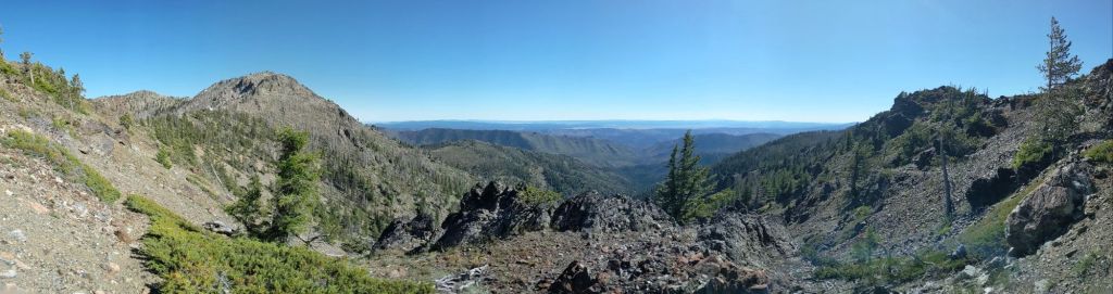
The Blue Mountains Trail (BMT) is a 530 mile footpath in Oregon, charting a wide arc through the northeast corner of the state from John Day to Joseph. It has more accurately been termed a “route” than a “trail” because it was not conceived of and built to be a singular trail at any point, but was instead established in 2021 by piecing together stretches of existing trails, decommissioned and active forest service roads, and at times, cross country travel to create a continuous path. This route takes the hiker through the Strawberry Mountain Wilderness, the Wallowa National Forest, and Hells Canyon, as well as many other wildernesses. It is unmaintained, unmarked, and fiercely rugged at times.
I first heard about the BMT when my husband John (who will be better known in this blog by his trail name, O’Well) and I visited Cascade Lochs, Oregon in 2023 for PCT Trail Days, an annual event for current and former Pacific Crest Trail Hikers to gather, see old friends, check out new gear options, and, above all, eat good food. The GHCC (Greater Hells Canyon Council) had a booth set up and were telling hikers about the newly established (as in, 2 years old) trail, and inviting folks to check it out. On the drive back to Eugene, I took a look at the website and after 20 minutes of browsing photos and reading the blog posts and trail reviews from the first group of hikers to make the initial groundtruthing effort, I was sold. I knew that this would be O’Well and my next thru-hike. I was fascinated by the challenge, the opportunity to be one of the first to hike this stunning trail (only 12 hikers have been known to finish the trail as of writing), and it was an opportunity to see a part of a truly beautiful state that so few got to experience. As someone who has hiked multiple long trails I can say that pristine wilderness is actually very hard to come by, and I still seem to be chasing that pipe dream at times.

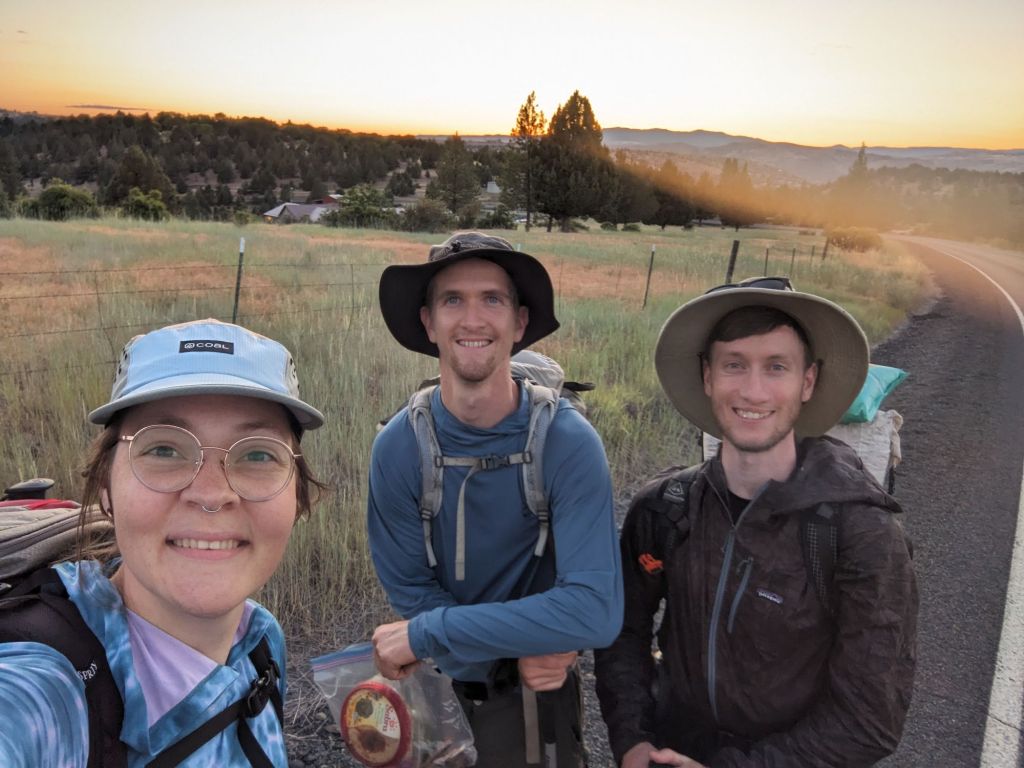
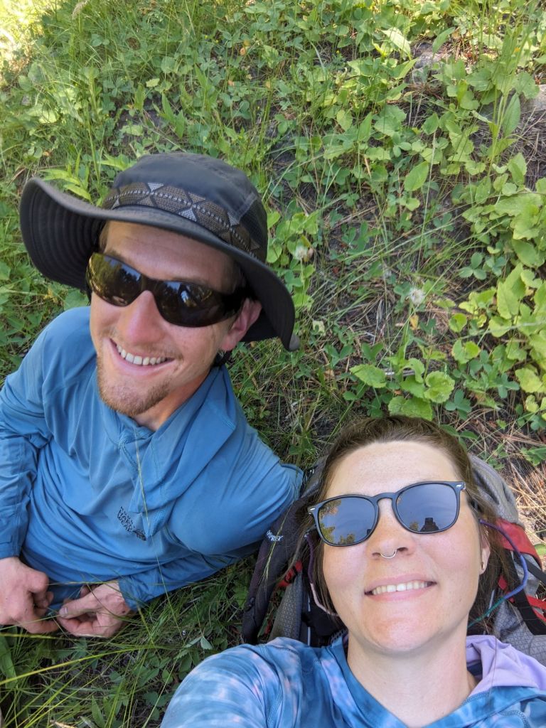
Getting to the trail was not as difficult as you might think, considering the remoteness. The day before we were set to depart, O’Well and I picked up our friend, Weston (trail name Gretzky) from the Eugene airport. We had asked a few people if they wanted to come hike with us this summer, knowing that it is a very remote and isolating trail with few hikers and not much of a community built up around it yet. We were very excited to have Gretzky along, considering he is essentially a part of our family. Not only did we all hike together for 800 miles in the California Desert on the PCT, and he was the one to perform our wedding ceremony in 2020, I also calculated that between the 3 of us we have collectively hiked over 15,000 miles, so I thought we should have ample experience to tackle the beast that is the BMT. We spent the evening catching up and the next morning we departed for John Day.
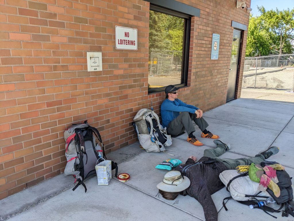
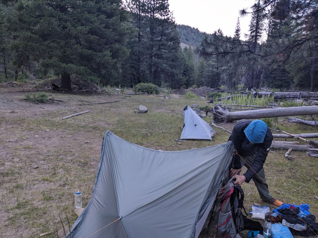
It was a rocky start. We were supposed to leave at 8:00 to drop off our truck with a friend and get a ride from another friend to the train station where we would catch our bus. We got our stuff loaded in the truck at 8 on the dot, turned the key, and found the battery was dead. O’Well very responsibly retrieved his homemade electric riding lawnmower and got the battery plugged in. I was biting my nails, but after 15 minutes of charging we were on our way. The rest of the morning flowed smoothly and we took the bus first to Bend, then transferred to a smaller bus which would take us to John Day. The journey began to get interesting on that second bus, driving through progressively smaller and more picturesque or old-timey towns. Our bus driver told us that the location he was dropping us off was kind of a big deal – that intersection was the only traffic light in the entire county. He very kindly detoured off the scheduled route (given we were the only passengers) to drive us down the highway to Canyon City, saving us 2 miles of road walking to get to actual trail. It was about 8 pm, 12 hours after we left the house that morning, and we were officially hiking the BMT. We walked 2 miles along first paved, then gravel forest service roads and set up camp in the fading light once we were on public lands. We ate some snacks before bed, lighthearted and cracking jokes. It has been a few years since any of us hiked a long trail, and we were delighted to be under the stars and in the dirt and together.
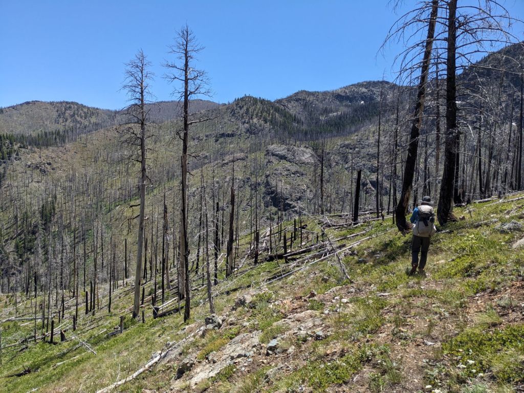
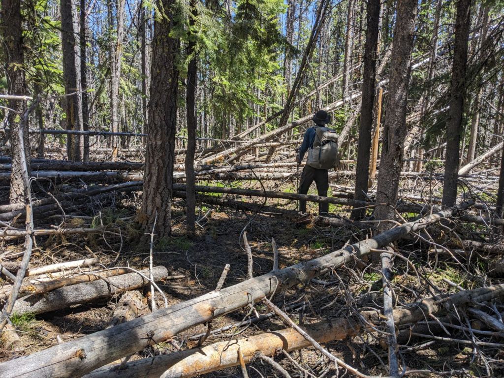
We started hiking in earnest the next morning, picking up 4000 feet of elevation in one shot. I did not sleep well, having the first night jitters and not being very tired (yet), but I forgot about that very quickly as I huffed and puffed up the forest service road. Even once we gained “cruising altitude” according to O’Well, and found ourselves on actual trail, we just seemed to continue going up, although at a more gentle grade. There was a brief section where we dropped 1500 feet, only to regain it on the other side, and while the descent was a break for our burning thighs, it posed other problems. We were moving through a burn area, and because the trail is unmaintained, this means that there are countless downed trees over the trail, as well as scrubby vegetation growing back and obscuring the trail often. We picked our way carefully down the steep grade, sometimes losing the trail, sometimes twisting ankles or sprawling headlong in the dirt. It was almost a relief to be climbing again on the other side, for some reason the vegetation hadn’t grown as thick on the east facing slope as the west facing slope we had descended and going up was much easier. At our next break though we discovered another problem with traversing unmaintained trail; we were all crawling with ticks. As soon as this was discovered a thorough tick check was undertaken, stripping off shirts and pants in the middle of the trail, “Can you check my back?” “Ugh, this one already started biting.” Tick checks became our first chore at every break.
We continued to gain elevation for the next several miles as we ascended to Pine Creek Peak. We stopped there for the day, camping in the saddle between the east and west peaks. It wasn’t an ideal site, we had a feeling the wind would pick up in the night, but there was another long descent after the saddle and we were sure not to find camping there. We had only traveled 14 miles that day, but we guessed we did something like 7,000 feet of elevation and we were completely gassed. We would just have to put up with some wind. We were all laid flat, hoping we could get some good rest and be ready to go the next morning. We had 5 days of hiking left to reach Austin Junction and our first resupply.
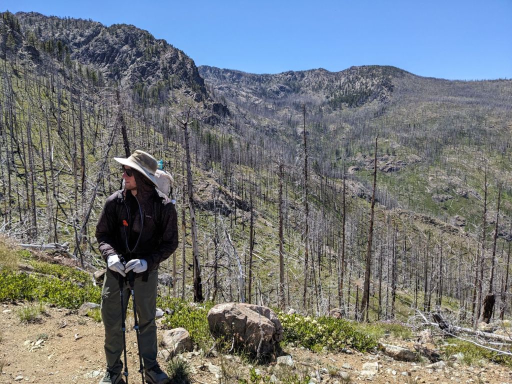
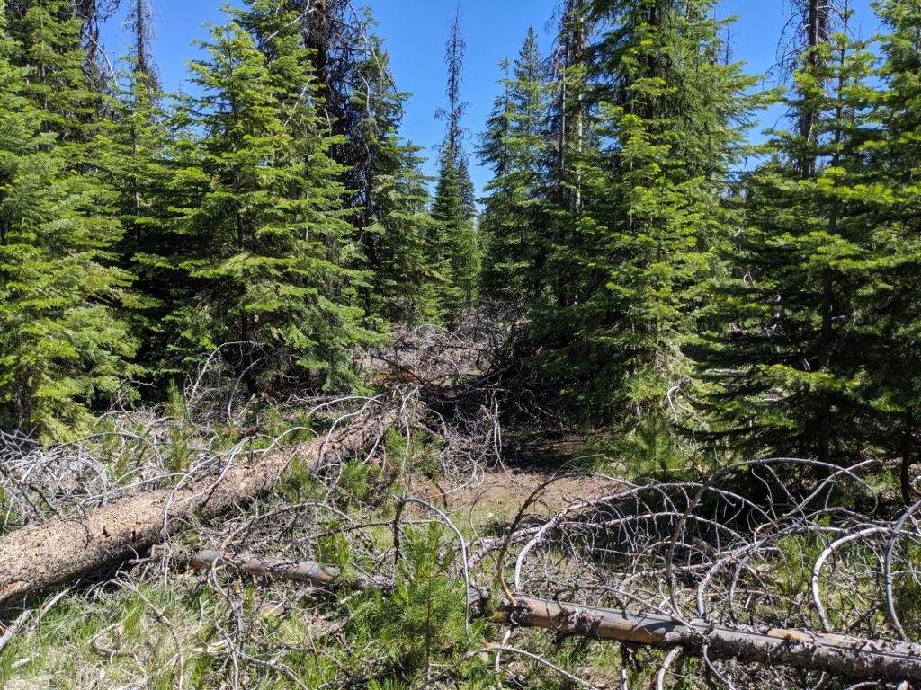
It did indeed get very windy overnight and I once again got little sleep. We woke up at 5:30 and it was still windy and quite chilly up there at 8,000 feet. I was moody setting about breaking camp, but once the hiking started my mood improved. The views were spectacular and the wildflowers abundant. I could already see that, challenging though the trail had already been, the rewards would be just as steep. It warmed up pleasantly as we made a quick descent, then rambled along the ridgeline. The trail quickly became easy to lose, at one point when we were traversing a gravely hillside it disappeared, probably a blow down had concealed a switchback while we continued on straight and we had to slip and slide our way precariously down the slope towards the “pink line” marked on our gps maps as the trail. Later in the day the trail was concealed by a dense thicket of woody brambles and we had to just follow the pink line as best as we could while trying to pick out the easiest path of travel.
We finally picked up a real trail again after traversing a beautiful, sandy meadow atop the ridgeline. I was in high spirits, deciding that any difficulty following the path was mitigated by the sheer beauty around us. I felt challenged, but up to facing that challenge in a way I hadn’t been sure I was. I felt confident in only the way I do when I am on mountaintops, free in only the way you can be when treading ground only occupied by elk and wolves, seeing views reserved only for those willing to undertake the adversity. I felt the presence of the life all around me, the weight of the consciousness of the pines, and I almost felt as though they whispered to me as I passed, welcoming me home to this place I had never been to, but to which I belonged so thoroughly. They greeted me as part of the greater life force imbued in all things, providing shelter and stability both to me and the other animals and small plants there in the wilderness. I whispered back my thanks.


The trail became very nice indeed, and we traipsed along it, relieved to not be bushwhacking anymore, or more accurately being whacked by bushes. The trail was too nice it turned out. We descended 1200 feet into a valley before we realized we had missed a junction (there being very few signs for such things) and gone 2 miles along another trail which likely led back to a trailhead somewhere far below. The only option was to retrace our steps back to the top of the ridgeline, and we had to began the steep climb back up. Gretzky asked if we shouldn’t try cutting across country at a certain point to save maybe a half a mile of backtracking on trail. “Look how close the contour lines are,” I pointed at the map along the suggested route, “The trail goes that way and then cuts back so you can traverse the hillside instead of going straight up it.” We followed the trail back, and it did save some steep climbing, but even the trail decided to go straight up the mountain at times. We made it back to the BMT having learned our lesson about keeping an eye on our map as we had now added 4 extra miles and 1200 extra feet to our day. The PCT this trail was not, all smooth, wide footpaths and well signed trail junctions and emblems (or blazes) on trees every so often to assure you that you are still on course.
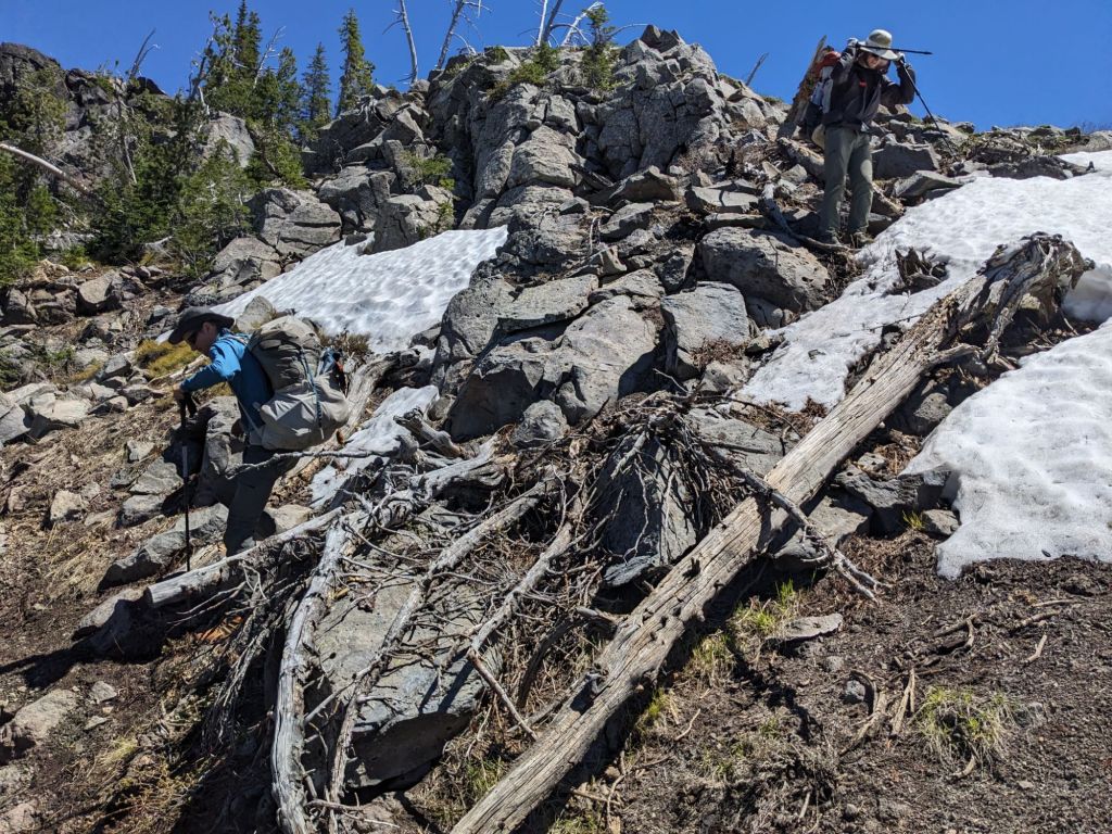
We got to our first snow crossing on the ascent to Strawberry Mountain. When we chose July to hike, we understood that one of the risks of hiking so early was the potential that the snow may not have fully melted off. This was not too daunting as we had all experienced snow crossings in Washington on the PCT in June, and we had packed microspikes to provide traction in such cases. On this particular crossing, the snow had melted off enough that we were able to circumnavigate it on the rocks. This was fortunate because the snow patch ended in a 1000 foot precipice and losing your footing on that snow would have been ill advised. We reached the saddle to Strawberry mountain and began the descent, and immediately realized that this was in fact the section we had brought our microspikes for. Up until then we had been feeling like they were just dead weight in our pack, but the backside of Strawberry Mountain was home to a cornice, melting off nicely but still very much obstructing the trail. Gretzky went first and carefully kicked steps into the snow. It turned out to be less steep of a descent than it looked from above and we all made it down without incident, although it took some extra time.
I greatly enjoyed the rest of the descent to Strawberry Lake, but the boys were feeling a little worse for wear. Gretzky’s feet were hurting and he had a lot of blisters. His situation was not unfamiliar to me as I had been struggling with too small shoes the week prior while training on the Oregon Coast Trail. I was worried that he would need to get new shoes, but the closest REI was in Bend and we didn’t have a lot of options for getting there. O’Well had packed an extra pair of shoes though in case his didn’t work out and he offered to have Gretzky try them out the next day. We had completed 15 miles that day (including our 4 mile side quest) and camped at Strawberry Lake.

The next day was another 15 miles, and we hit our first milestone, we completed our first section: 7D. The day was a little bit of slog. We had a long climb in the morning up to Graham Mountain, and then continuing up to Peak 7710. For some reason the mosquitoes were swarming, whereas they had been virtually nonexistent on the opposite side of the valley or by the lake. As long as you keep moving, you can generally avoid the worst of the bites, but something about the whine of the mosquito and the need to constantly check your shoulders and wave around your face to keep them off always seems to get to me and I get a little bit crazy. Once we hit our highest altitude they mellowed out, but I didn’t escape cleanly unfortunately and would be itching for days after.
We got to camp very early that night, around 6. Because the days were long we all felt like there was so much more time to hike, but we weren’t physically ready to do more miles yet and we felt it important to pace ourselves.
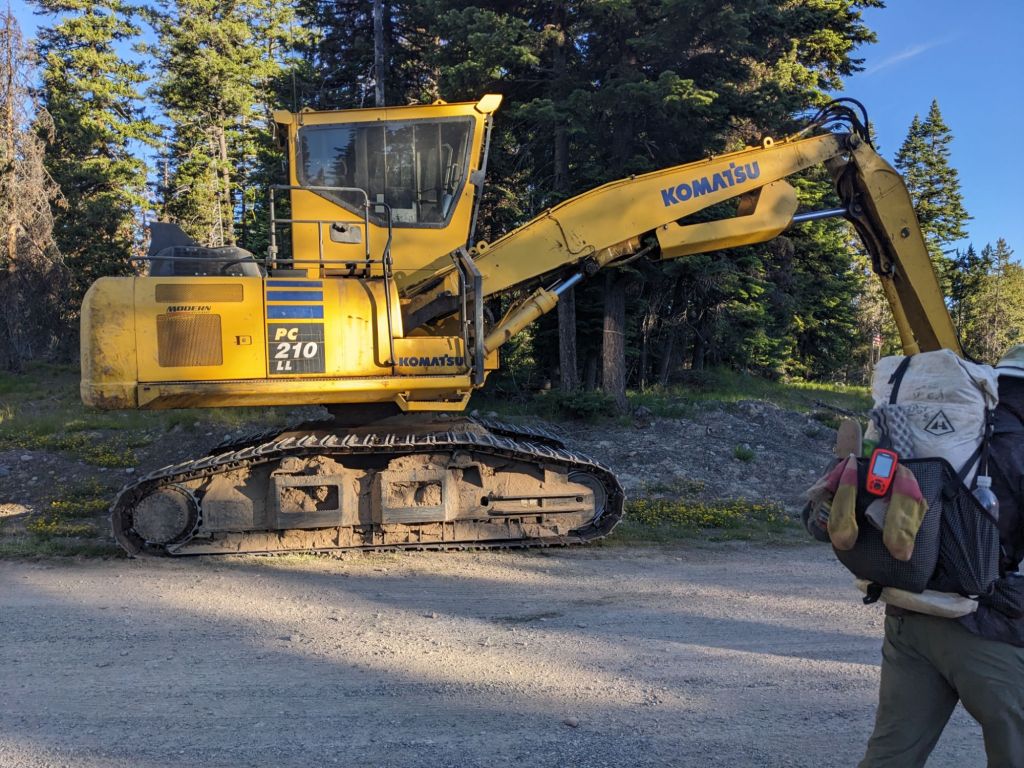
We camped near a paved road crossing and were woken up before dawn by some logging trucks bringing in equipment. I was able to fall back asleep despite the disturbance, the exhaustion finally having caught up to me, but I was workne up again when we started hearing trees being felled at 5:30. “Do we need to get out of here?” I asked O’Well and he shrugged, “We should be fine.” This was not too encouraging. Then a huge piece of logging equipment came clattering down the road and making a huge racket. O’Well said they were just staging equipment, and by the time we left camp there was no one to be seen.
The elevation that day was very mellow, but the trail conditions more than made up for it. We started the day on a gravel forest service road which disappeared before long and we had to travel cross country to find the Starvation Trail. The pink line took us up and over a boulder field which had us using our hands much more than we are generally used to, and then another steep ascent through the dense growing pine trees. When we finally did find the “trail”, we had a nice meander along a Ridgeline but we frequently lost the trail and had to keep a close eye on our maps. Once again the trails seemed to be mostly used by elk, and game trails can quickly lead you astray. Another time we were following a trail, but it was not the correct one and we had to cut cross country once more and scramble down a steep bank to regain the route. After that the trail became easier to follow, but the Horseshoe trail was a mess of blowdowns, all piled on top of each other and criss crossing haphazardly. It was probably a 3 mile stretch, but it took us a long time to make any progress needing to find routes over, under, around, or sometimes through the mess of logs.
Though the trail is unmaintained, we had been making efforts to improve the conditions as we went. Sometimes this just meant sweeping sticks and logs out of the path, other times it was righting a collapsed rock cairn or, in O’Well’s case, clearing a blocked culvert. On sections with lots of blowdowns, we spent a lot of time snapping limbs off the dry, dead logs to create easier routes through the mess. We seemed to be the first people to have traveled the trail since the winter, given how tangled everything still was.
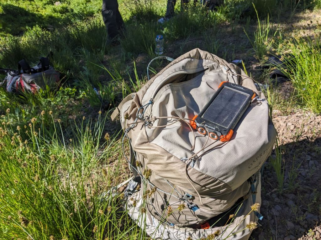
After clearing that section the trail consisted of primarily forest service roads for the remainder of the section to Austin Junction, intermixed with short sections of cross country travel or bushwhacking overgrown sections of trail. That day we began increasing our mileage, doing 17.5, and then 18 each day for the next two days to Austin Junction. The weather was getting hotter and the gravel road walking was monotonous and dusty. The climbs and descents may be long but they were gradual and our bodies handled the miles well enough. We found other ways to keep us occupied, examining the setups of the off grid, OHV campers we saw, reminiscing about past hikes, or cracking jokes about things O’Well did. He had a battery bank with a built in solar panel someone had gifted him, and he fixed it to the top compartment of his pack known as the brain so it could charge all day. He claimed it was not a good battery or panel, being very knowledgeable about such things, but he babied it anyway, calling it his “comfort solar panel.” Gretzky joked that O’Well now had one brain cell.
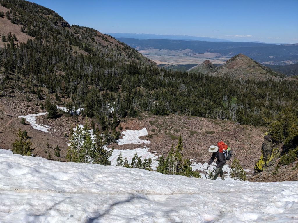
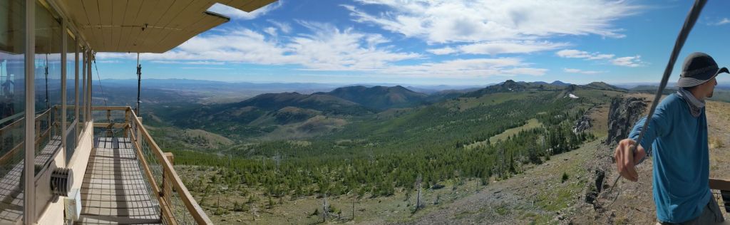
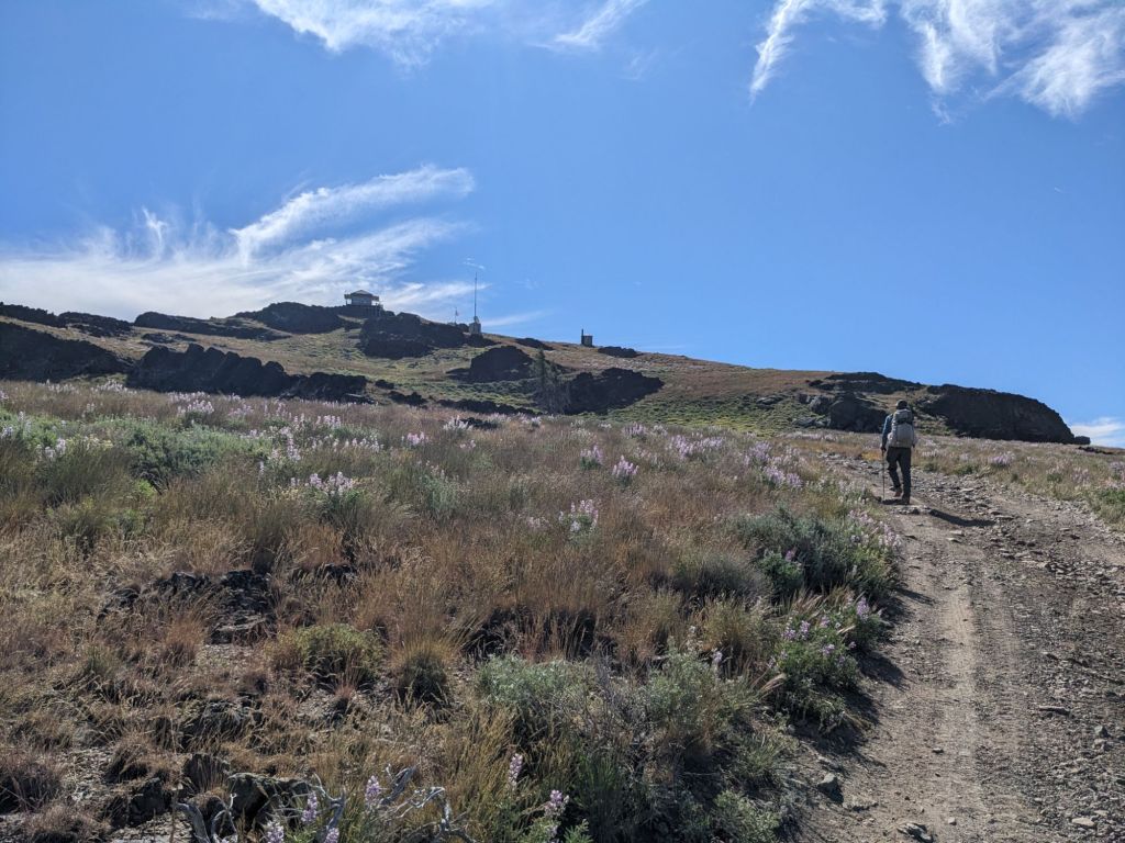
We had two days of long water carries, needing to pack 3 liters each to last the whole day. Fortunately our packs were getting lighter as we had eaten most of our food, but water is very heavy and the mornings were a struggle. On the second to last day of the section we had a long, gradual road walk up to Table Rock first thing in the morning, and I really felt the extra weight in my pack. I didn’t realize until we were almost to the top that there was a fire lookout tower at the summit, and we were surprised when the lookout invited us up, offering us water top offs, and bags full of candy to take with us. We chatted with her for 30 minutes or so about her job as a lookout and the fire that had come through the wilderness a few years back. She warned us that the next section was a bit of a slog as we traversed the lower foothills between Strawberry Mountain Wilderness and then Wallows, but that the payoff would be spectacular. We went on our way, happy hikers.

The road walking was indeed a slog. We made it to Austin Junction at 5:30 on our 6th day out of John Day, with just 30 minutes to spare before the Austin House restaurant closed for the evening. We needed to pick up our resupply boxes we had mailed to ourselves there, and we were looking forward to some cold beverages and food after the long road walk in 95 degree weather. They exceeded our expectations, kindly staying open long enough for us to eat and allowing us to camp for the night out behind the store. The greatest thing of all though was the shower. Washing off the 6 days of sweat and grime, and taking the opportunity to wash my socks in the shower too, I felt like a new person, and confident for the first time in several days that I didn’t have a single tick on me.
We had completed Section 7 of the BMT, just a few miles shy of the 100 mile marker, and we were now Sumpter bound.
This series is dedicated to my grandma, Jeannine, the first thru-hiker in the family.

Thank you, Erika, for your sweet dedication to me!! I teared up. I feel like I’m hiking with you as I read the blog! Hugs to all of you, Gretzky included!
LikeLike
thank you for blogging Snots. Great adventure!!
LikeLike