“I’m really trying not to just think about laying down,” I mused as we trotted down some forest service road or another. “Like I keep thinking about everything I want to do when we get to town – lay in a bed, take a shower, eat a whole cantaloupe, watch a movie. I go over and over exactly what I’ll do. Like when I’m hiking all I can think about is not hiking.”
“It is weird,” Gretzky piped up from somewhere behind me, “When you’re at home and laying in bed and thinking, ‘I should really get up and do something.’ We always want what we don’t have.”
“Hm,” I agreed, “Still, I think there’s something about hiking that makes you a little more focused on what’s in front of you. There’s not so many distractions and you’re so focused on your body all day. Whether you’re miserable and your feet hurt, or you’re looking at the most beautiful view you’ve ever seen, you kind of just have to take that as it comes and then move on to the next moment… I think that’s all enlightenment is, honestly.”
When we zeroed in La Grande I did not eat a whole cantaloupe, despite how many times I thought about it, I think demonstrating that thinking about anything other than the present too much probably is wasted energy. We did have a very productive day of doing not much at all. We watched two movies and ate plenty of other foods, making a trip to Safeway to resupply for just two and a half days to get us to Tollgate where we would pick up our next box. I went to bed without thinking too much about the rest of the trail. This would be our one and only zero, and we were just under halfway through the trail. Because of the prescribed nature of our resupplies, we didn’t have much wiggle room in the schedule, which meant we had to hike 290 miles in 2 weeks with no breaks. This meant picking up the pace a bit from what we had been doing and hiking at least 20 miles every day for the next 14 days. I knew this would be challenging given the increasing difficulty in terrain and continued cross country sections, but I also felt mentally prepared for it. I had come to this trail for a challenge and I knew what I signed up for.
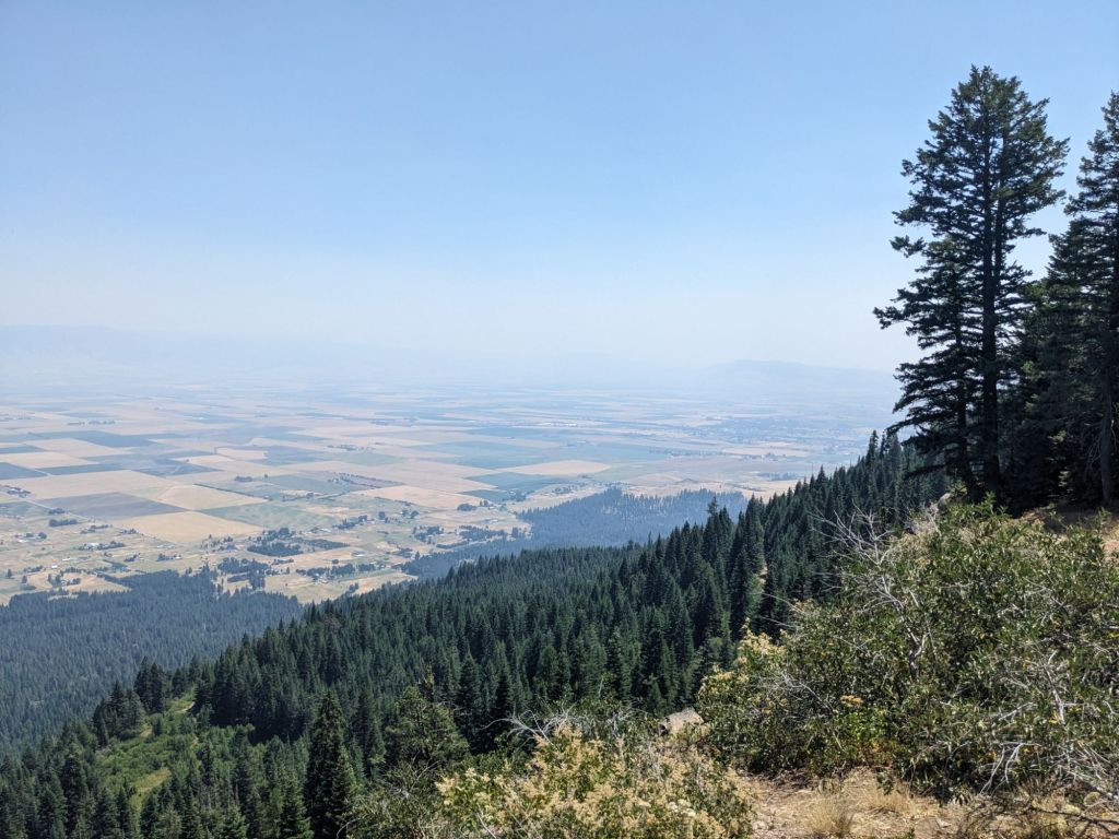
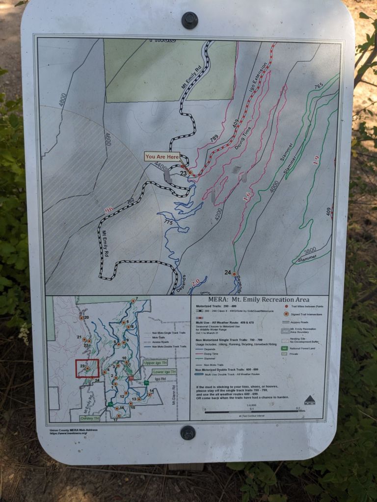
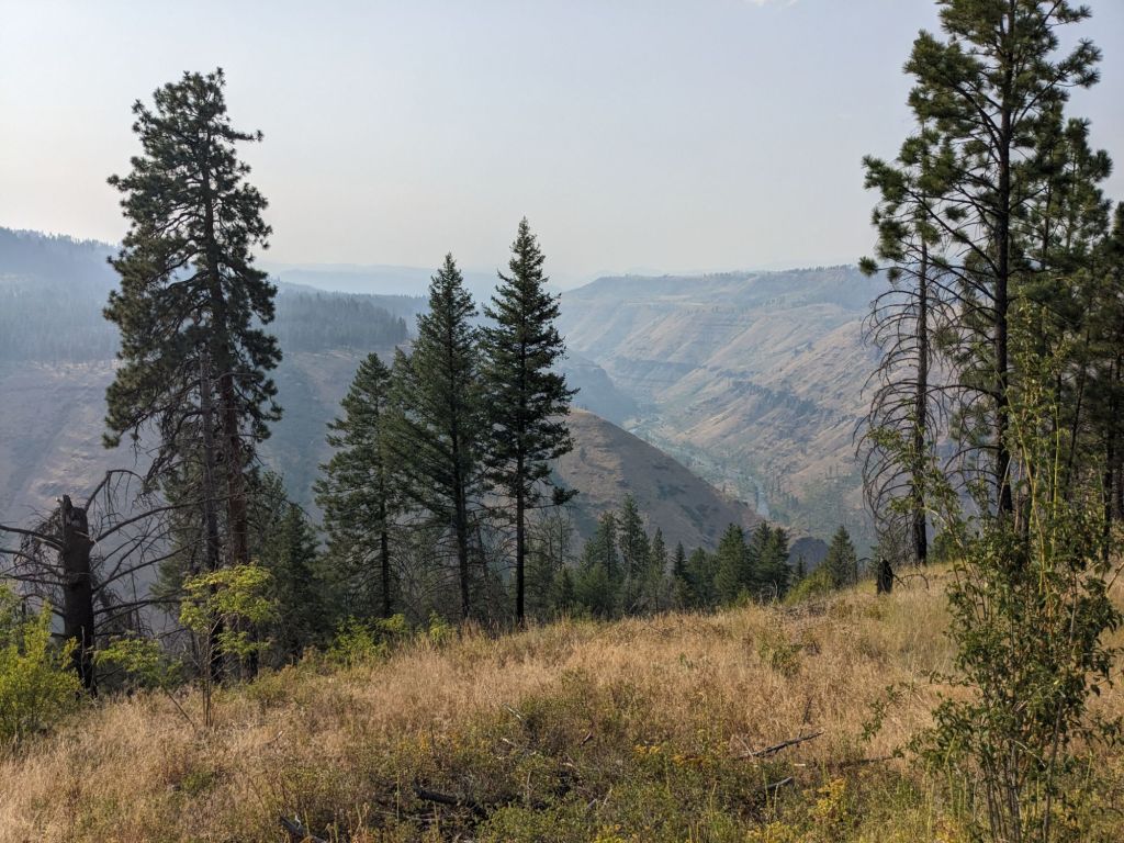
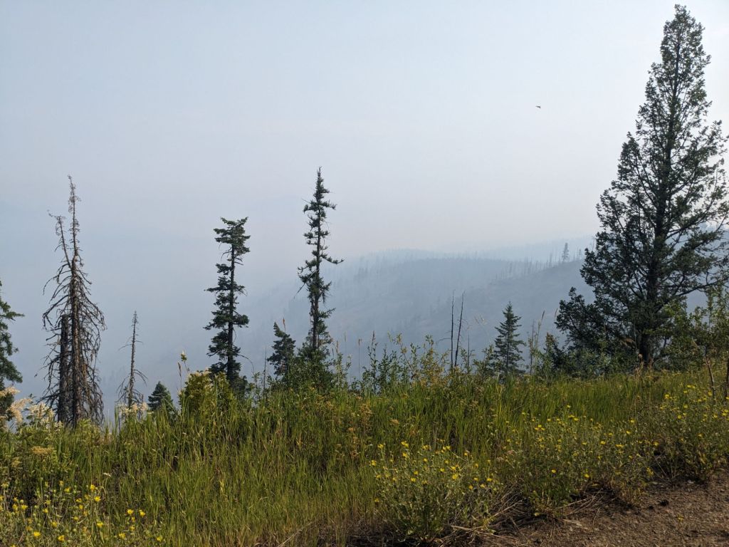
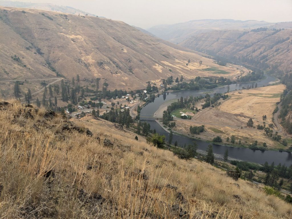
We had breakfast in our hotel room and hiked out around 8 am, making a pitstop for a quick second breakfast burrito on the way out of town. I felt the benefits of the rest day as we began a long and sometimes quite steep ascent up Emily Mountain. We gained elevation quickly but my body felt strong and refueled, and our packs were unusually light for leaving town. We caught sneak peeks of La Grande behind us, but it was fairly shrouded in smoke. We had checked on the wildfire maps while we were in town and there were several big fires burning in Washington, Oregon, and Idaho and we weren’t sure which was contributing most to the smoke coverage, but none were burning close enough to the trail to be of concern. We were aware that another fire could crop up much closer, but all we could do was continue walking. By the afternoon we escaped the worst of the smoke which seemed to be clinging to the valley and my wildfire concerns abated.
We passed through a recreation area for mountain bikers that seemed quite popular, seeing multiple vehicles which was highly unusual. It was huckleberry season and we saw one family out in force, scouring a patch. “I didn’t think anyone had done the whole thing,” the mother was surprised when she found out what we were doing. We also ran into a forest service worker a little later as we breaked at a crystal clear, ice cold spring. He was one of those people who is just high on life, but he thought we were crazy for hiking the BMT in July. Given our experiences with the heat and the mosquitoes, I thought he might have been right. There wasn’t much of an option to hike any earlier though, and August would have also been hot. In September you may run into more rain and even wintery weather conditions, so in all I decided that everyone just has to hike their own hike.
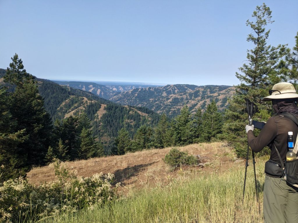
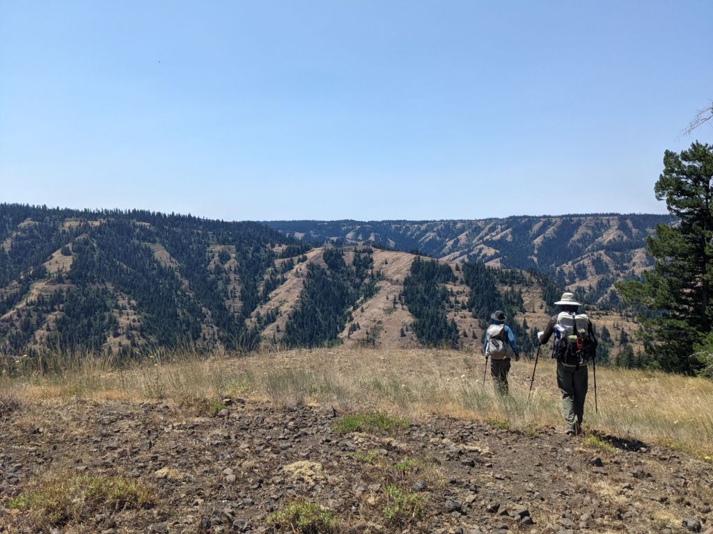
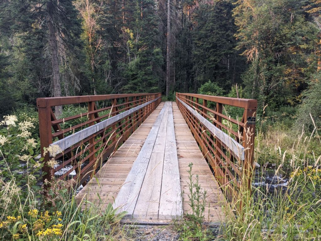
The climbing mellowed out and we road walked for most of the day along the ridgeline, getting some lovely views but feeling a little bored by the end of the day, about 21 miles out of La Grande. We camped almost precisely at the midpoint of the trail.
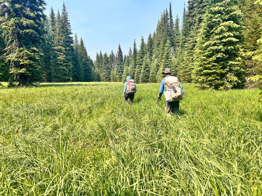
The next day was a little more of a slog than the day before had been. It seemed like I hadn’t been eating enough, a sure way to make the miles drag on. Although the terrain was fairly easy, road walking along Shimmiehorn Ridge, I struggled with feeling bored and lethargic and tired of my thoughts. I was caught in that mental loop of wanting to be doing something else. Eating first lunch helped and I felt ready to hike again, but we very soon left the forest service roads and started a cross country section down the ridgeline through meadows which were filled with rocks hidden in the tall grass, ready to twist your ankle at any step. This was manageable until we dropped into the trees. The slope became significantly steeper, and the underbrush was incredibly dense. With there being no trail, we were left to try to stick to the pink line as best we could, but we also had to navigate around fallen logs and dense growing thickets, branches and thorns tore at our clothing. I tripped once while climbing over a downed tree and sat down hard on a broken branch, tearing a hole in the seat of my pants and I am sure I had a bruise for many days after that. We were lucky no one had any serious injuries – Gretzky took a headfirst tumble at one point, luckily landing on his pack.
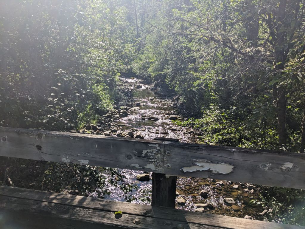
I about cried when we got to the valley floor and found a pleasantly rushing creek and an overgrown but flat forest service road. I stripped off my clothes to cool down in the creek, my freshly laundered clothes were already sweat soaked.
“This trail gives you whiplash,” Gretzky pointed out, “It’s either the worst hiking you’ve ever done or the easiest, and there’s no in between.”
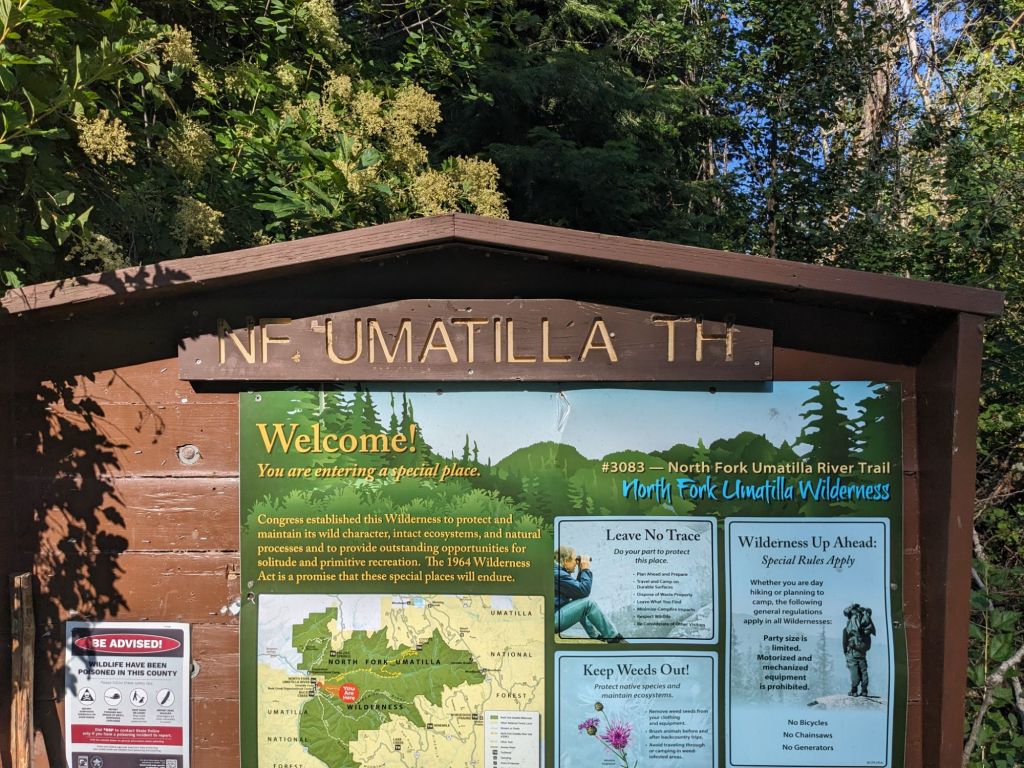
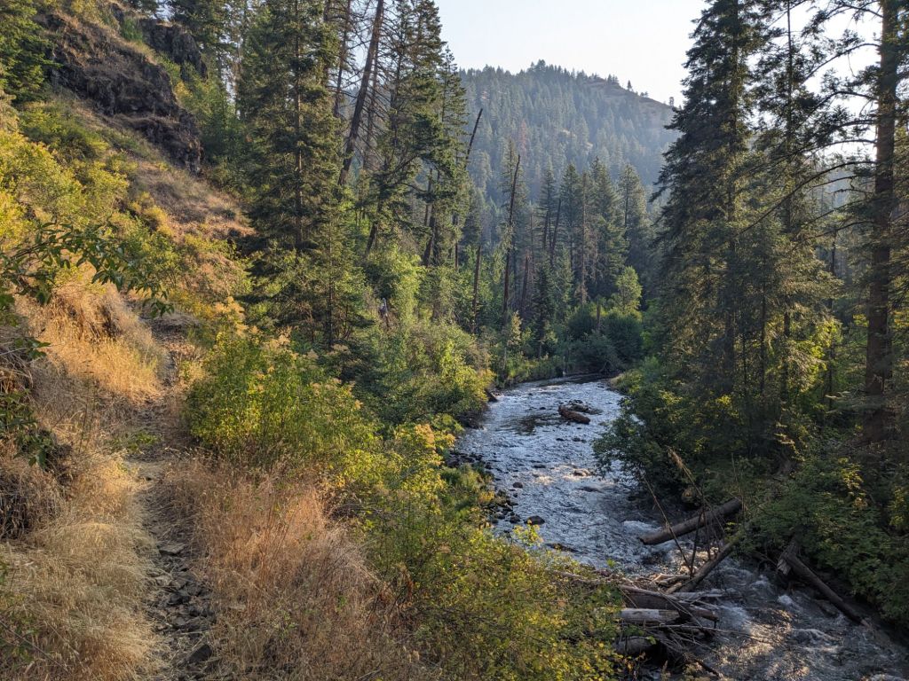
We thought we had a few more miles of cross country and were relieved to find the data points on our map were misleading and there was actually a very nice road along the South Fork Umatilla river with only a few washed out points where we had to clamber down into the river bed. Throughout the day we had been seeing a fire helicopter we thought was doing training passing back and forth. It had a hose extending down from the big belly to pull water from rivers or lakes, and we realized it was actually dumping loads of water on strategic hilltops, more likely for actual fire suppression than training. When we arrived at the Umatilla Forks campground we saw signs for level 1 evacuation which was somewhat concerning as we likely wouldn’t be notified if that evacuation notice was increased. We hiked on to make our 20 mile goal for the day, camping along the North Fork Umatilla river.
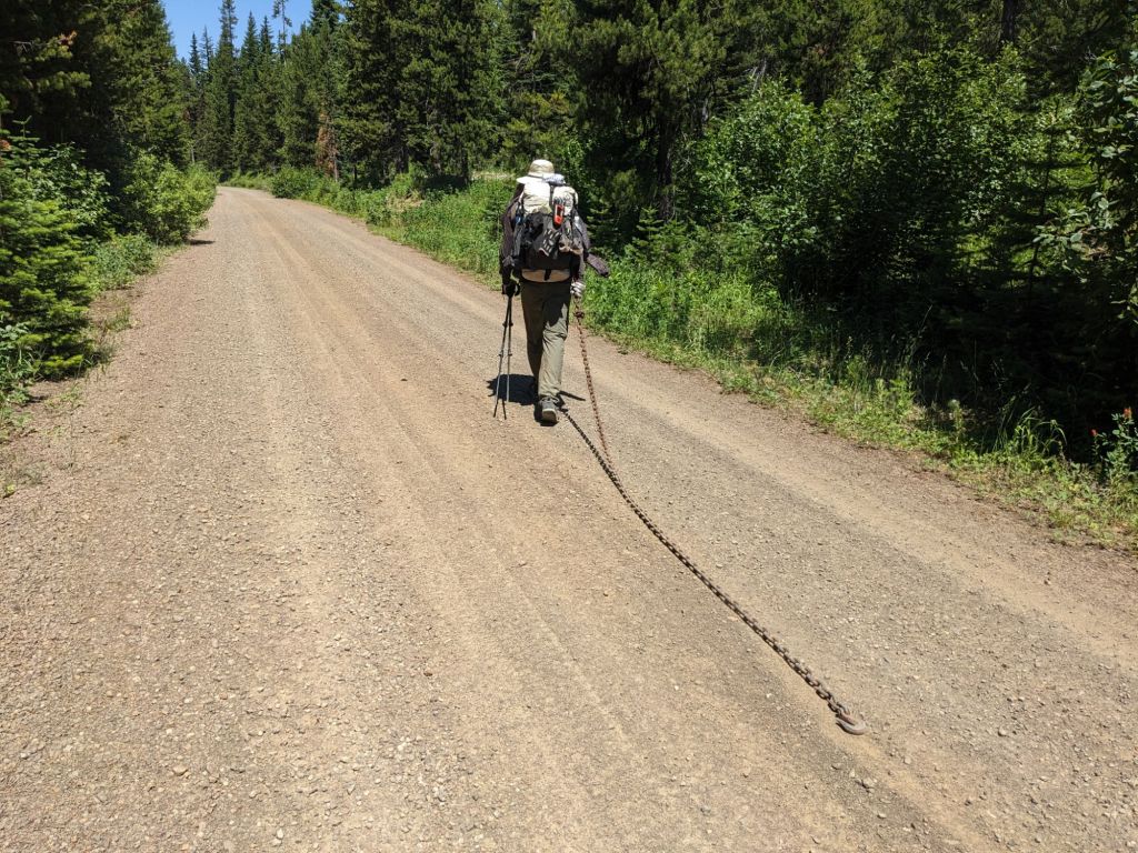
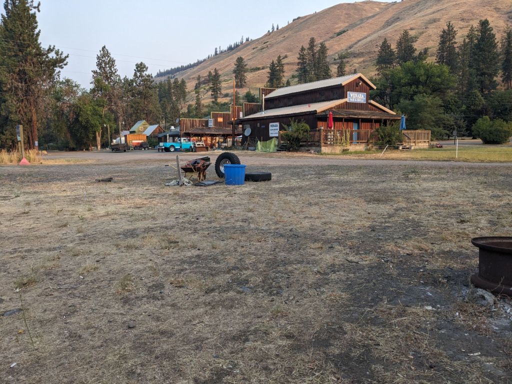
We finished out the subsection at Tollgate the next day. That morning we had a big climb out of the river valley to gain Coyote ridge, but the trail was, for once, a nice trail and we made good time. We ended up back on forest service roads for several miles getting into town. O’Well found a 12 foot long chain that had clearly fallen off someone’s truck and decided to begin his and Gretzky’s old game of “pick up the random object and carry it for many miles” which they had started in the desert on the PCT as a way to stay entertained on long, boring road walks. It started with him dragging it behind him by hand, giggling to himself as the chain rattled and bumped, and then he started snaking back and forth down the road. When he got tired Gretzky took a turn, and they took turns dragging the chain for the next mile. “Your turn!” O’Well tried to insist, I flat refused to drag a chain which weighed as much as my pack. Eventually their arms got tired and O’Well decided to use a carabiner to clip the chain to his pack and drag it that way – it weighed 25 pounds though so he had to clip it to his shoulder strap. They tried each carrying one end to diminish the weight. I was tired of the shenanigans and ready to get to town and a good meal and had left them behind. I turned to look when I heard the noise from the chain stop, and found that they had picked up the chain and were literally carrying it. They carried it another mile and a half before finally abandoning it on the side of the road, about a half a mile before the store where we would pick up our box.

We claimed some outdoor seating at the Tollgate Crossing store to save the other patrons from our stink, ordering some expensive burgers and lemonade. After lunch and picking up our resupply box, we were repacking our food bags on the front porch and watching traffic going by on the two lane highway when we saw a truck with an RV breakdown in the oncoming lane of traffic while trying to make a left turn. They happened to be in a curve, so traffic coming either direction couldn’t see the blockage, or that cars were getting into the opposite lane to get around the trailer. It was a very dangerous situation, and the driver came moseying up a few minutes later, asking if anyone could pull him out of traffic.
“There’s a tow chain just half a mile up the road if anyone needs one,” O’Well announced to the crowd of onlookers who had gathered.
We hiked another 6 miles out of town that night, making it a 20 mile day, and camped on the South Fork Walla Walla River. I saw plenty of bear scat, but no bears and I was pretty confident they were more interested in the plentiful huckleberries than our food. When we got to camp, I went down to the river alone and stripped off all of my clothes and wobbled my way barefoot into the chilly water, rinsing off the layers of salt I had accumulated in just 3 days since we had showered. I felt reborn.
The next morning we once again had to hike up out of the river valley – this was becoming a theme. On the climb out we encountered a lot of dirt bike tracks on the trail, and kept saying to each other, “Who would ride a dirt bike down here?” It was not a trail designed for motor vehicles and seemed very dangerous. Our question was answered when we stopped for lunch nearing the top of climb. We had grown accustomed to not seeing any other hikers and were sitting in the middle of the trail as it was a pretty steep incline, when I heard a rhythmic sound growing louder. I had a moment of panic as I realized it was the sound of wheels and we began to scramble to our feet, ready to jump out of the way as a dirt bike appeared. Fortunately his engine was off and he was moving slowly.
“How’s the trail down there?” He asked us as we slowly moved our scattered gear out of the trail.
“I hope you maxed out your life insurance policy,” O’Well joked.
It was very hot and we were grateful to find a lovely piped spring at the top of the climb, spewing cold, crystal clear water into the air. We spent some time filling our bottles and I dunked my head under the jet, hoping wet hair would keep me cooler for the afternoon. We saw two sets of forest service workers while we were there, a large fire crew and two guys who did trail maintenance. We chatted with the trail crew for a little bit, trying to gauge how bad the trail was along the Weneha River heading into Troy. Our databook warned that, as of 2021, the trail was in very bad shape due to blowdowns from a significant burn in 2019, and we were getting to the point where we would do anything to avoid unmaintained trail in a burn area. They let us know that the trail probably hadn’t been cleared yet and we decided to go ahead and take an alternate route which would keep us up on Hoodoo Ridge, then Eden Ridge before dropping us down into Troy, instead of following the river valley and save us a lot of effort. It was more forest road walking and not technically the BMT, but we felt like we didn’t need to make our lives any harder. The workers were also concerned when we told them about the dirt biker, feeling that he shouldn’t be riding solo on that section, although I was still shocked that the trail was open to motor vehicles at all. Eastern Oregon sometimes felt more like the wild west to me.
We hiked 22 miles that day and shared a campsite along an FS road with some hunters who had the biggest tent I had ever seen.
The next day we hiked our longest day of the whole trail – 25 miles. It was mostly downhill and all gravel roads, so we were able to keep our pace up, getting to Troy a little before 8 where we would be picking up our last resupply box for the trail. We were desperately hoping we would be able to get a shower and do laundry, as we wouldn’t be going through any towns for the next 9 days – basically Troy was our last bit of civilization before we finished the trail. Unfortunately, we hadn’t realized until after 5:30 on Sunday that the store was closed from 5:30 Sunday until Thursday morning, and we were arriving on Monday night. This meant we hadn’t been able to contact the store and ask them to leave our six and a half day resupply boxes somewhere we could get them, and we weren’t sure if we were going to be able to access them at all. There was nothing really for us to do but to keep walking. I was nervous about what we would find in town, but after 20 miles I stopped worrying because I couldn’t think about anything but how sore my feet were and how much I just wanted to get there.

I rolled into town first, I had been listening to music to stay motivated and kept my pace up. The sun was starting to go down, and I looked dazedly around as I walked across the bridge over the Weneha river where it meets the Grande Ronde. There were a few guys sitting in lawn chairs in the water down in the Grande Ronde and I saw one wave, I waved back, feeling a little like I was in a dream. “Town” is a strong word for Troy. It’s a small community with a public laundry and shower facility, and RV park, the store where we were supposed to pick up our boxes, and a handful of houses. The store was of course closed, so I sat at a plastic picnic table until Gretzky and O’Well arrived. O’Well quickly spotted what I had not, which was our resupply box sitting outside the locked store. I would have been relieved if I wasn’t so tired. Unfortunately, Gretzky’s box was not there. We had written our expected arrival date on the outside of the box, and by some stroke of luck we happened to get there on exactly that day – the store owners knew to leave the box out for us. Unfortunately Gretzky had put a day a few days ahead, when the store would be open. There were a couple guys outside one of the RV’s hanging out so we figured we had better ask them what they knew. They turned out to be two loggers there for the summer for a job, and they were completely hammered on cheap beer, although it was not unfortunately Keystone Light. They were very impressed by how far we had hiked, but highly uncouth, asking John before I walked up if picked up any women on the trail, although it was certainly not worded so diplomatically. They did let us into the public showers however and we were at least able to shower, although we ended up washing our laundry in the river.
The next morning we made some more inquiries about the store owners from the only two people we saw lingering around. We finally deduced where the owners lived, but that on their off days they usually went into Enterprise to operate another business. Gretzky knocked on their door to no answer so this seemed to be what they had done. One gentleman very kindly offered to let him scrounge his pantry for some hiking food though, and he came away with enough lunches for three days. The section was six and a half days long.
“Well, what’s the plan?” O’Well asked me as the three of us converged at the plastic picnic table.
“We don’t have enough food to wait here two days for the store to open, and we don’t have time anyways.” Our final resupply of the trail was to take place at one of 3 potential locations between Troy and Wallowa Lake, the terminus. There were no towns along the route, and at our pace that would have been a 9 day food carry. The option for most BMT hikers is to have someone meet you at Buckhorn Overlook, Cow Creek Bridge, or Hells Canyon Overlook. I had asked a couple friends who we knew liked to take road trips if they would be willing to meet us in the middle of nowhere, a 10 hour drive from Eugene, and they had very kindly agreed. Throughout the entire trail up to this point, we had the time pressure of knowing that we needed to meet them on July 28th or 29th due to their work availability, and that because of our planned miles that would probably have to take place at Hells Canyon Overlook. This moment was essentially where that entire plan came to a head – were we going to be able to make Hells Canyon Overlook in time?
“We’ll split our two person resupply three ways,” I decided. There were no other options and there wasn’t much to discuss. We had to keep hiking and we only had the food that we had. “We can either slow down and meet them at Cow Creek Bridge instead of Hells Canyon Overlook so we don’t have to hike as many miles on limited rations, or we can stick to the plan and just get there.” It would be almost a week before we got more food either way, and Gretzky and O’Well both voted to just stick to the plan; I agreed.
There was nothing left to discuss, so we shouldered our packs and hiked out of town. I knew it would be almost 10 days before we would be back in civilization, and that we were probably going to be a bit hungrier than we were used to, but I felt largely at peace. Mostly just because there were a lot of ripe plum trees on the road out of town.


Such fun to read your well-written blog, Erika!! Thanks for taking me with you! I’ll look forward to reading the last section! Hi to Oh Well1
LikeLike
Coops! I forgot to identify myself! Love ya, Grandma
LikeLike